
The persistence of the Niña phenomenon, which influences the jet stream’s position, will have consequences on temperatures and climate this winter, especially in North America. However, for Europe, a worrying scenario is also envisaged.
Typically, La Niña appears at intervals of one to two years alternating with its warm opposite El Niño and is characterized by a temperature anomaly over part of the Pacific Ocean. Over this area, a colder-than-average water temperature is associated with La Niña and a warmer temperature is associated with El Niño.
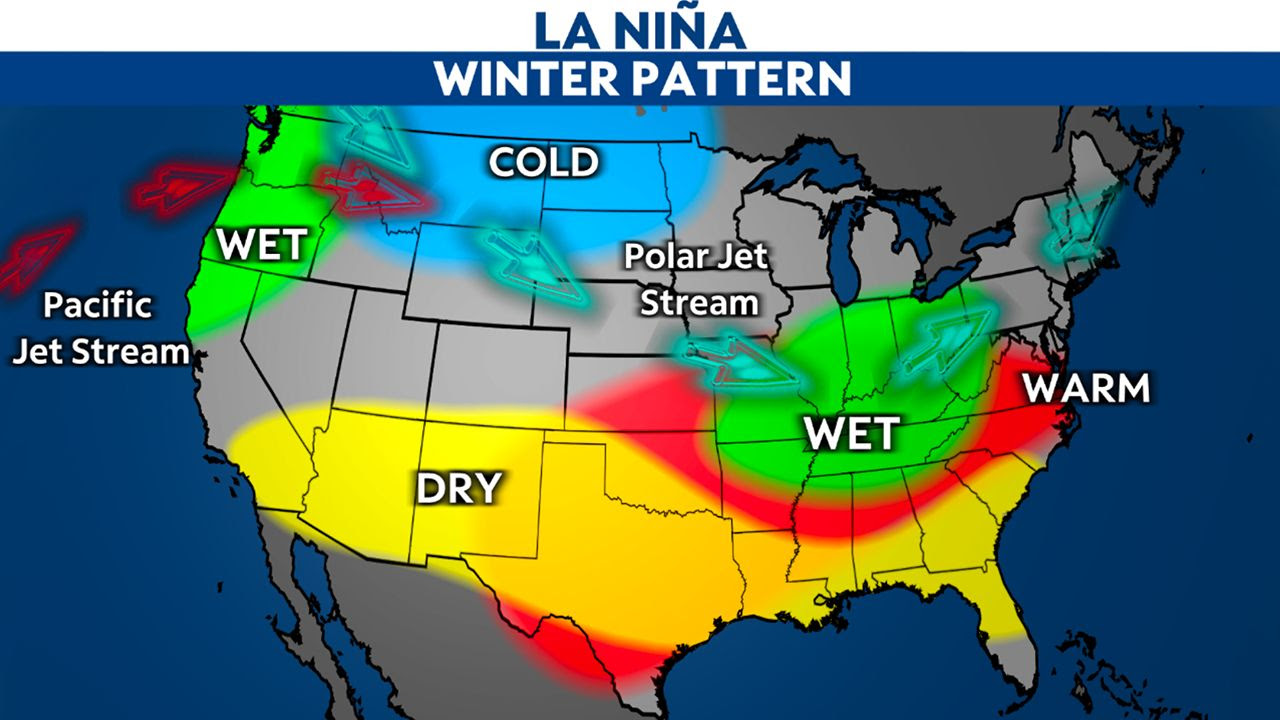
Weather forecasts from the National Oceanographic and Atmospheric Administration, NOAA, predict that the phenomenon will strengthen for the winter of 2002/2023 for the third consecutive year. La Niña generally blocks the high pressure over the northern Pacific Ocean, which pushes the jet stream further north. This phenomenon causes a very cold winter over Canada and a very wet one over the northwestern and northeastern United States and the Great Lakes region.
Conversely, the winter is warmer and drier over the southern half of the United States, as has occurred in 2020 and 2021. The Severe Weather Europe site compared forecast models from the European Center for Medium-Range Weather Forecasts, ECMWF, and the British Meteorological Service, UKMO.
The ECMWF model predicts a significant snowfall in Canada and a deficit in the western United States. In contrast, the UKMO model predicts a relatively classic winter with a lot of snow starting in December and especially in January over the northwestern and northeastern United States, the Great Lakes and Canada.
These forecasts are relatively close to those of the last two years, characterized by a substantial snow cover in the western United States and, for the winter of 2021/2022, in particular, a historically warm, dry winter in the south of the country.
The impact of La Niña on the European climate is unknown, either because it does not exist or because the current state of science does not allow us to know. Nevertheless, the two models, ECMWF and UKMO forecast a large snowfall deficit over Europe in November, December and January, especially in December, and temperatures are not expected to be cold enough to promote snowfall except at high altitudes.
Long-term forecasts are still experimental models that may have large margins of error. Still, if these forecasts are confirmed, the snow deficit over Europe is bad news for biodiversity, water resources and tourism.
Comment here